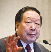
Deren Li
Li Deren, an expert in photogrammetry and remote sensing, comes from Dantu of Zhenjiang, Jiangshu Province. He was selected as a member of Chinese Academy of Sciences in 1991 and a member of Chinese Academy of Engineering in 1994. He got his bachelor and master degrees from Wuhan Technical University of Surveying and Mapping respectively in 1963 and 1981. In 1985, he got his doctor degree from University of Stuttgart, Germany. He was awarded the title of honorary doctor from ETH Zürich, Switzerland in 2008.
Li Deren has concentrated on the research and education in spatial information science and technology represented by remote sensing (RS), global positioning systems (GPS) and geographic information systems (GIS). During his studies in Germany since 1982, Li Deren proposed a new iteration weighted method for gross error location based on a posterior variance estimation, which has since been named “Deren Li Method". In 1985, he completed theoretical research in the separability of model errors, which advanced the reliability theory of Dutch scientists to the separability phase. His theory has “scientifically solved a hundred-year-baffling problem in geodetic science". Li Derenhas successfully supervised the studies of over 80 MSc candidates and over 100 PhD candidates and has published over 600 papers and 11 books. He has won many national and ministerial level prizes, such as The Sci-tech Progress Award, National Excellent Textbook Award, Award of the Excellent Educational Achievements, etc.
He has served successively as the President of Wuhan Technical University of Surveying and Mapping, Director of Wuhan University Academic Board, Director of the National Laboratory for Information Engineering in Surveying, Mapping and Remote Sensing, Vice-President of Hubei Provincial Science and Technology Association. He is the standing member of Division of Earth Science of Chinese Academy of Sciences, Vice-Director of National Major Scientific Project “High Resolution Earth Observation System”, member of Sixth Science Committee and Strategic Research Conuncil under Ministry of Education, member of National 973 Expert Advisory Group, member of Chinese Post-doc Expert Committee, member of National Space Expert, member of National Remote Sensing Center, member of European and American Alumni Association, President of European and American Alumni Association in Wuhan, Vice- President of China Society of Image and Graphics, Expert Advisor to China GIS Association, Vice-President of Chinese Society of Surveying and Mapping, Chief Scientist of China Center for Resources Satellite Data and Application, Senior Consultant to the China Global Positioning System Technology and Application Society, Founding President of Asia GIS Society, the third and sixth President of Professional Board of International Society for Photogrammetry and Remote Sensing, member of the Euro-Asia International Academy of Sciences, Consultant or Honorary Professor of over 50 universities.